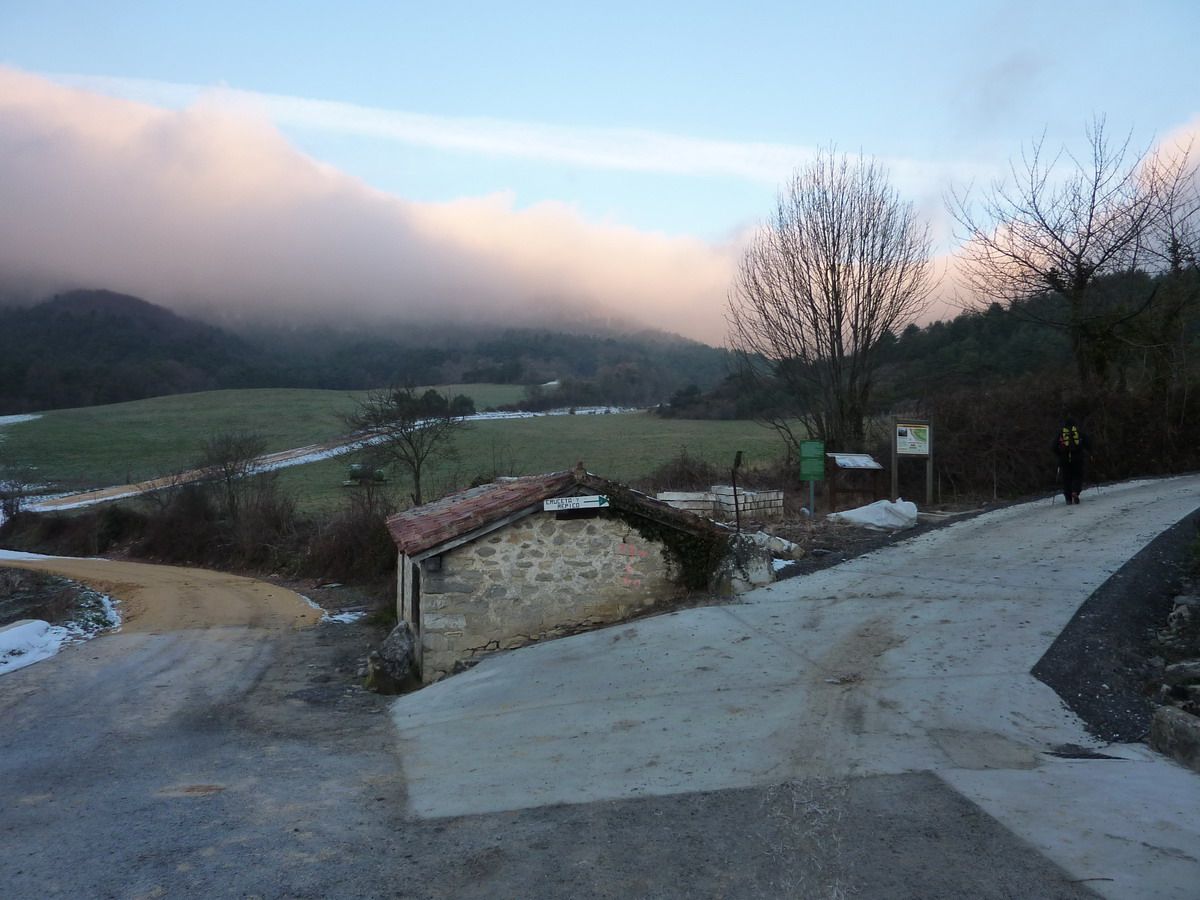
The idea was to use a track Rota to know Arkamu saw, or at least its western end, from the village of Arrian. But weather conditions were that arose as an early-morning about 13km, to stay within a short walk to the Peña Colorada (1131m).
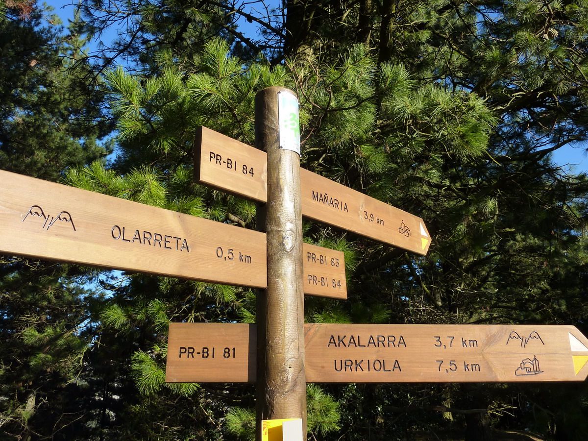
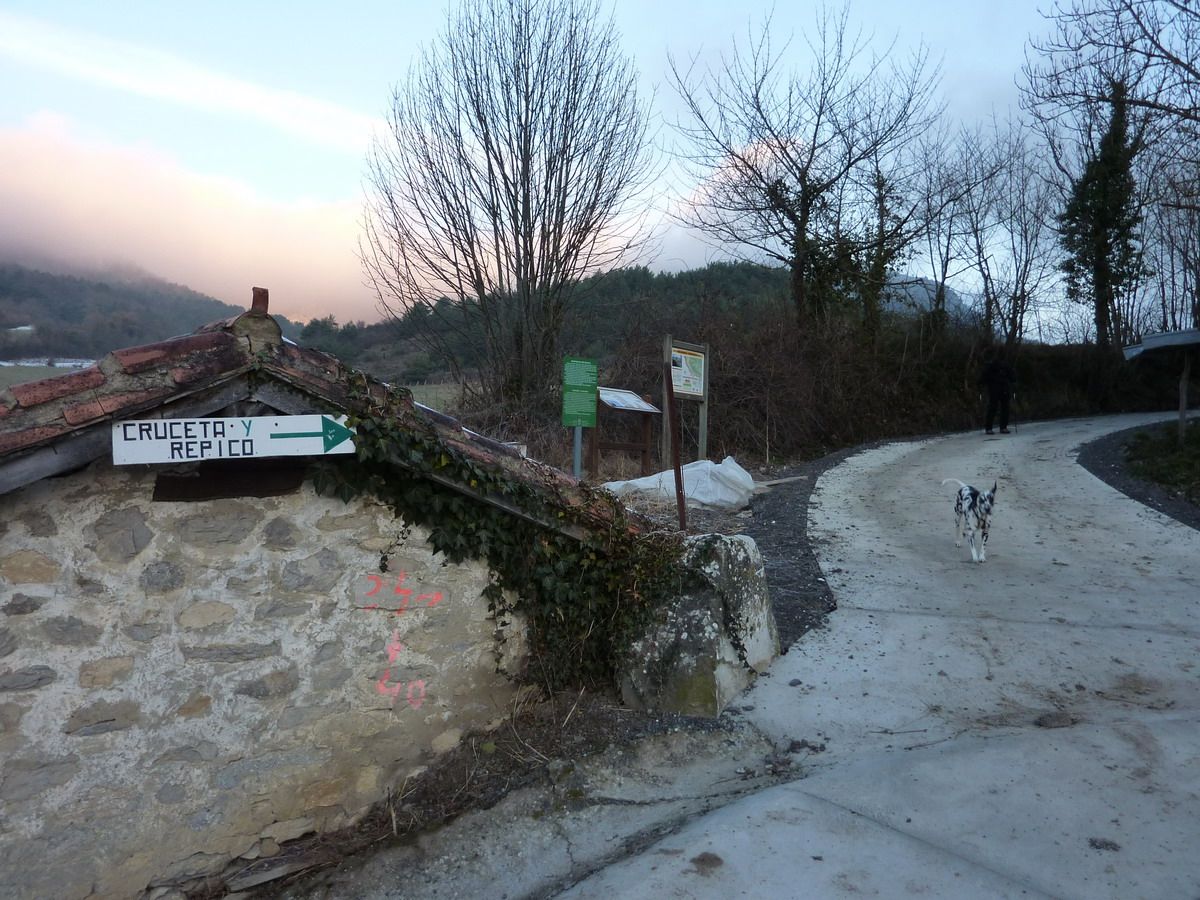
route is no problem, and indeed outside the town of Arrian there is sign that marks the direction to take (make Cruceta and Repiko), then just watch for detours and for an hour you reach Melaria the wicket and then to the Peña Colorada is a little more.
Tour:
On paper
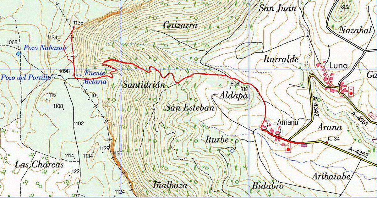
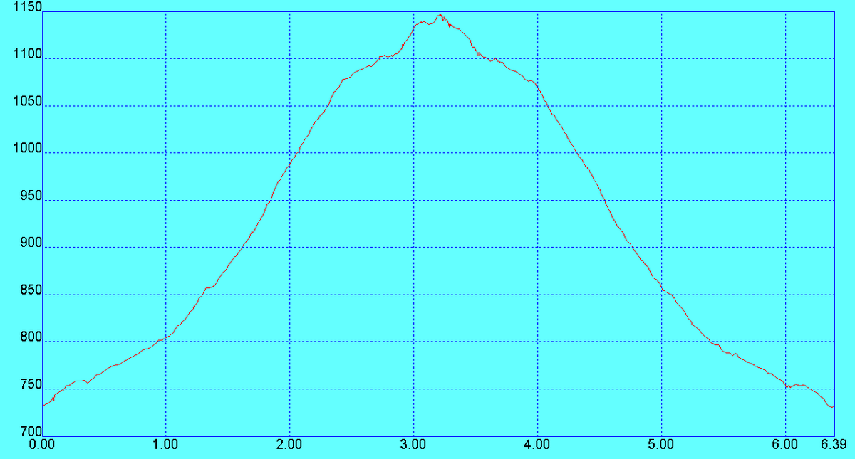
More information: Area: Sierra / Massif Arkamu Access: Arian Summit: Peña Colorada (1131m) Travel Distance: 6.4 km ascent: +420 m
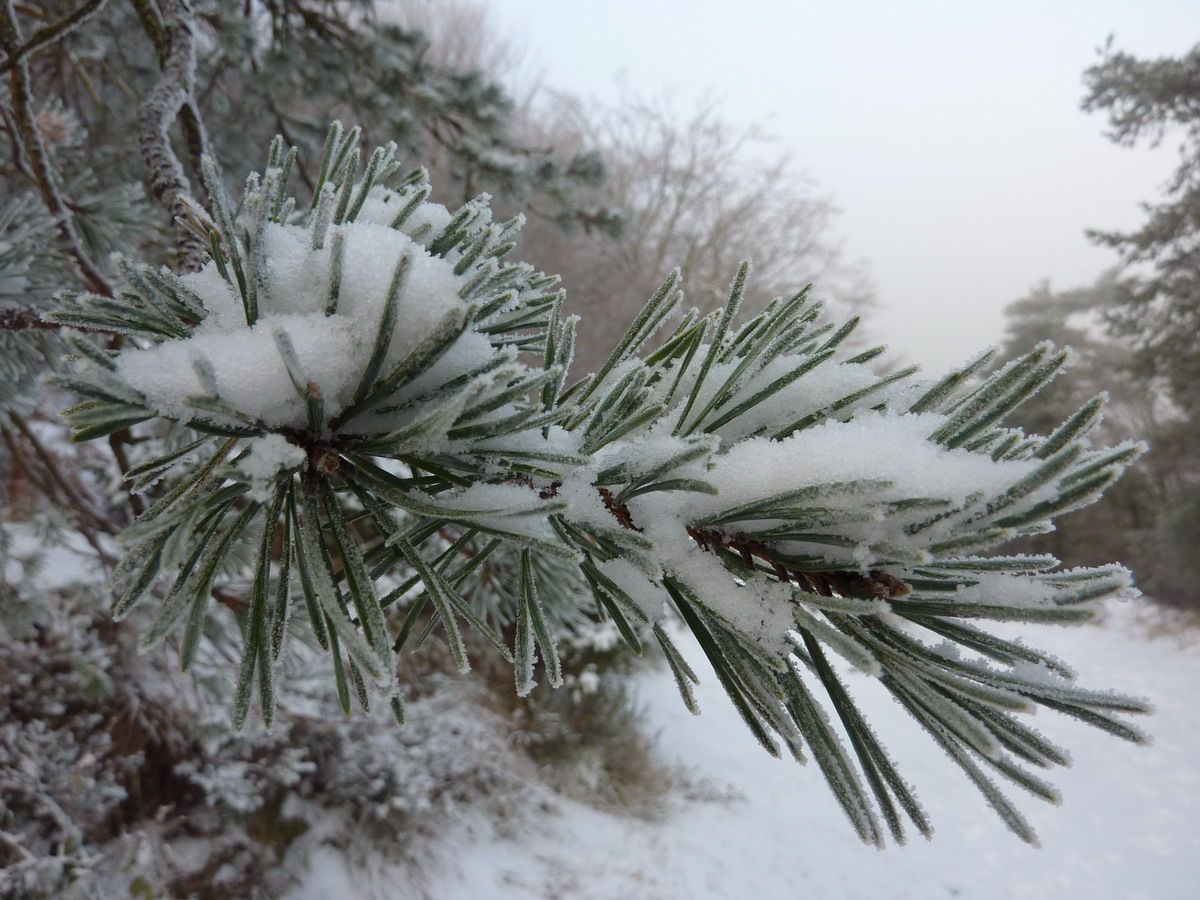
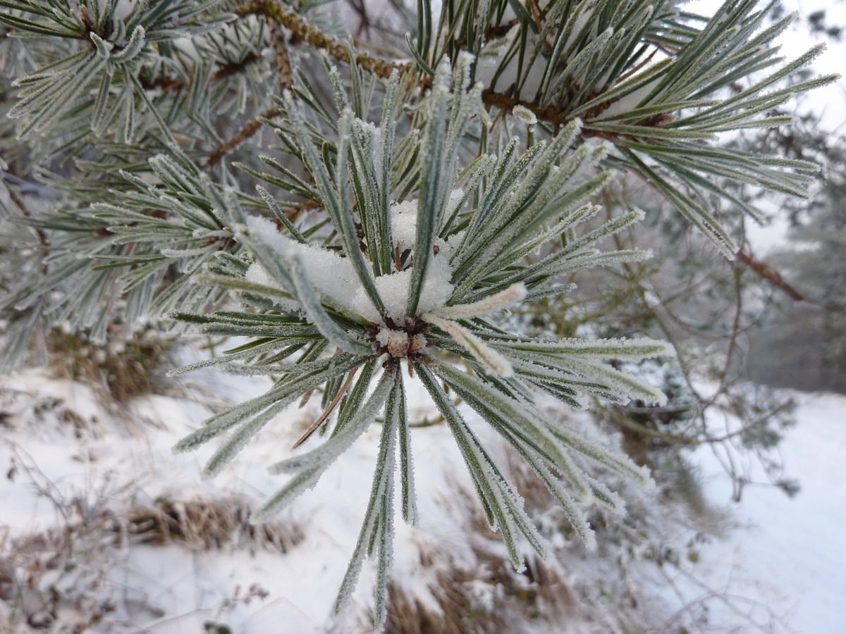
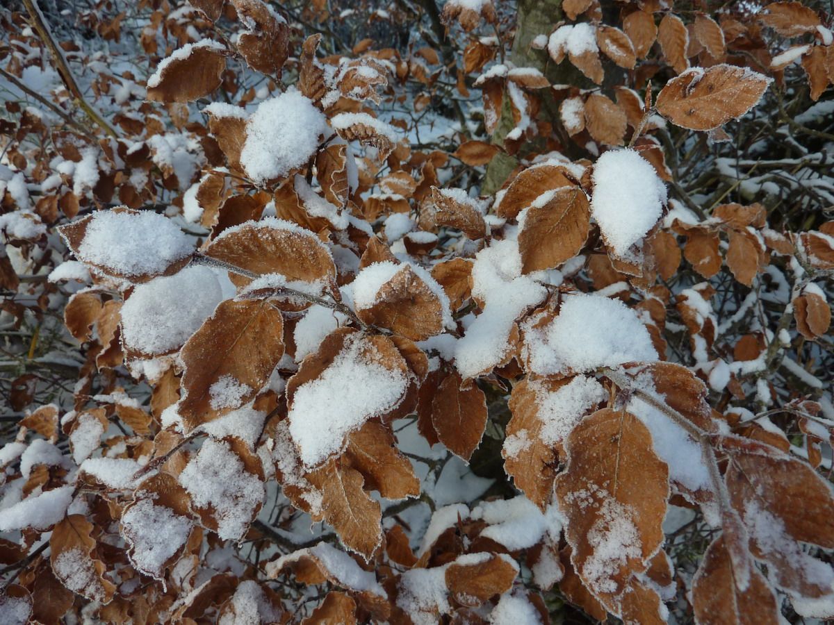
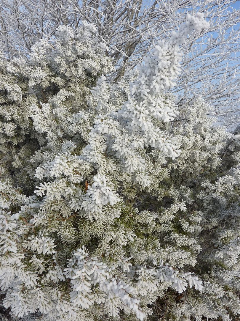
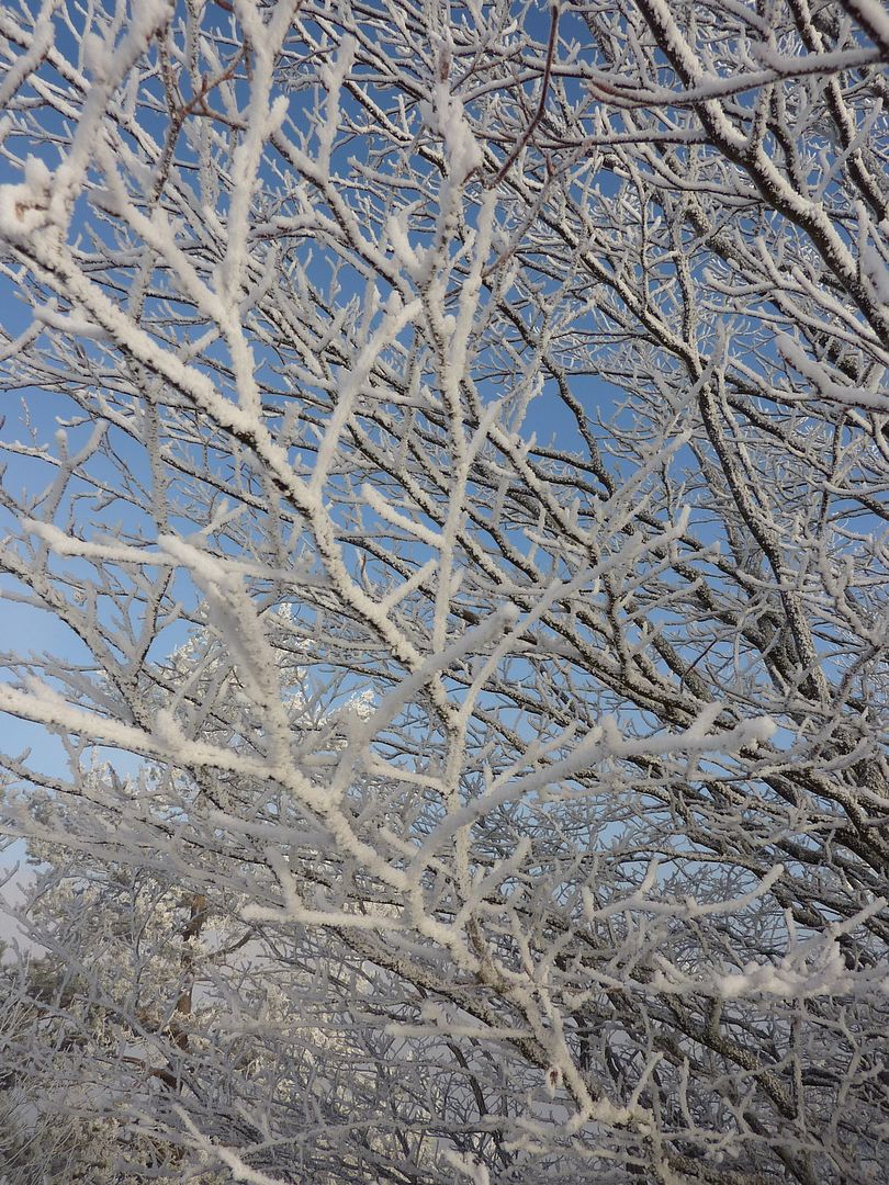
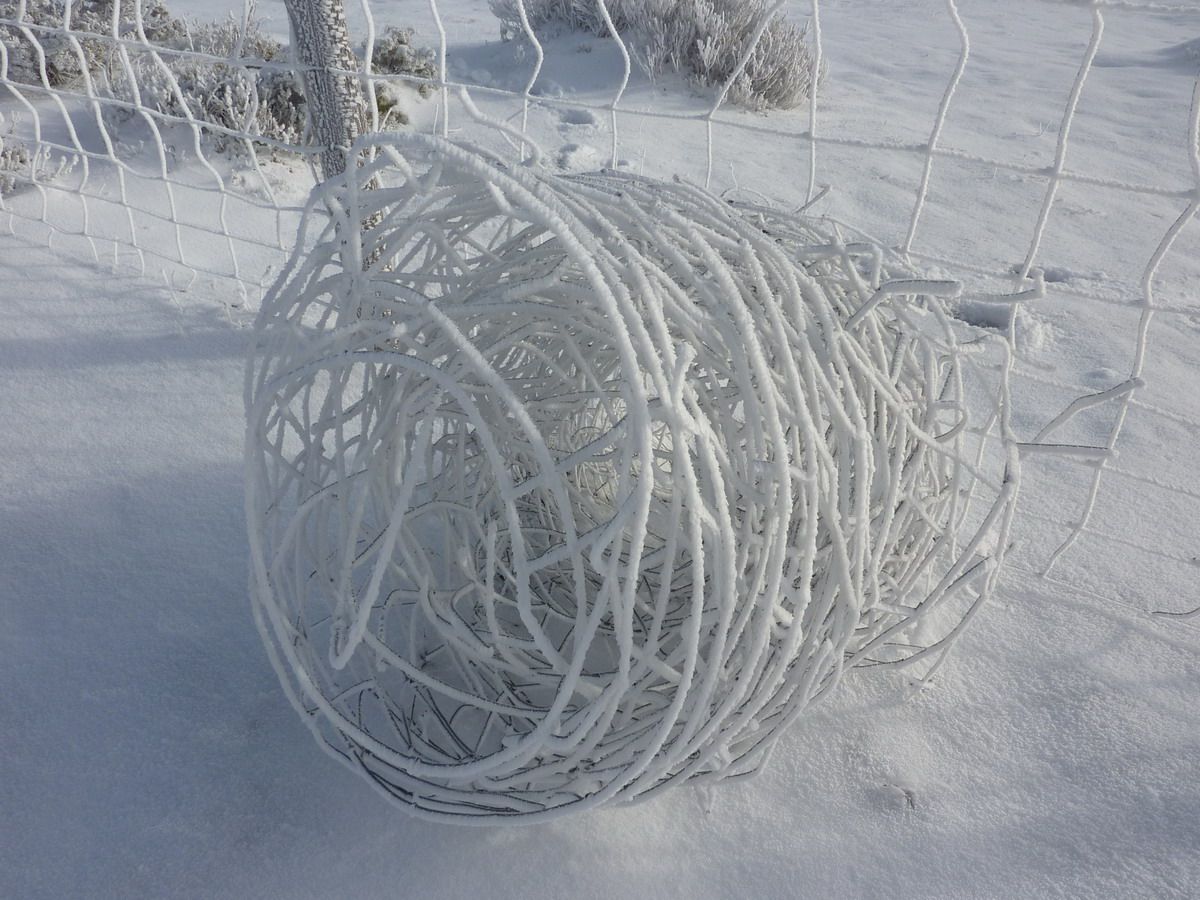
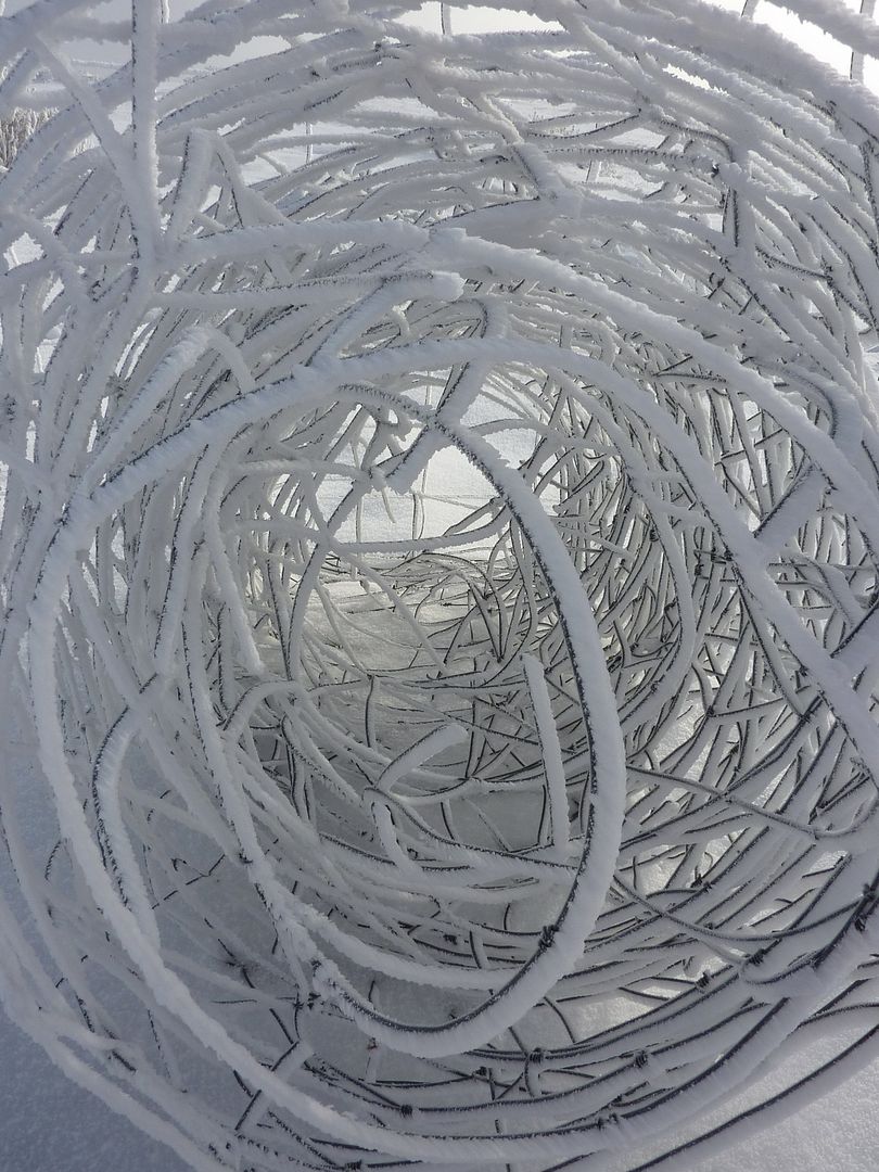
As there was no hurry and no views would be spectacular to make me spend some macro and play with the forms that had left the wind and snow ... Here are the pics. Leaving
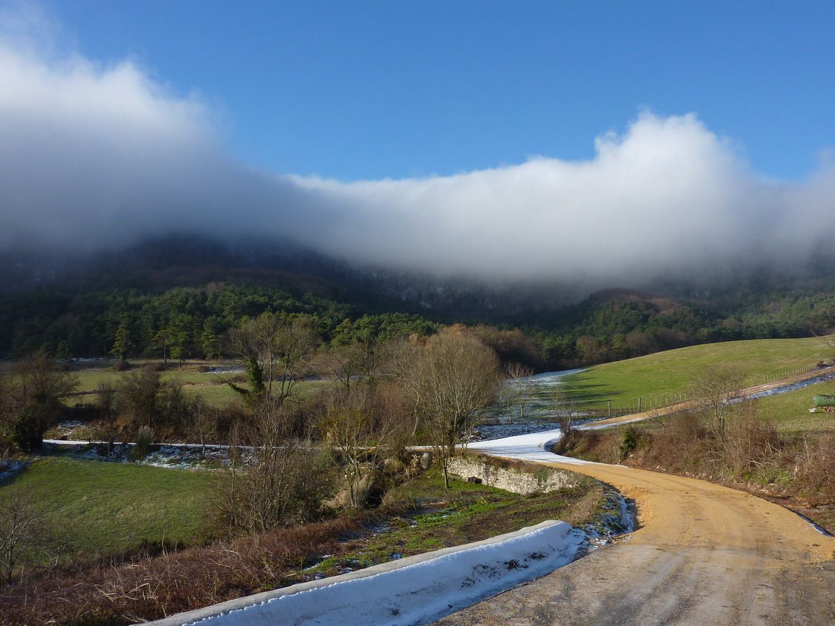
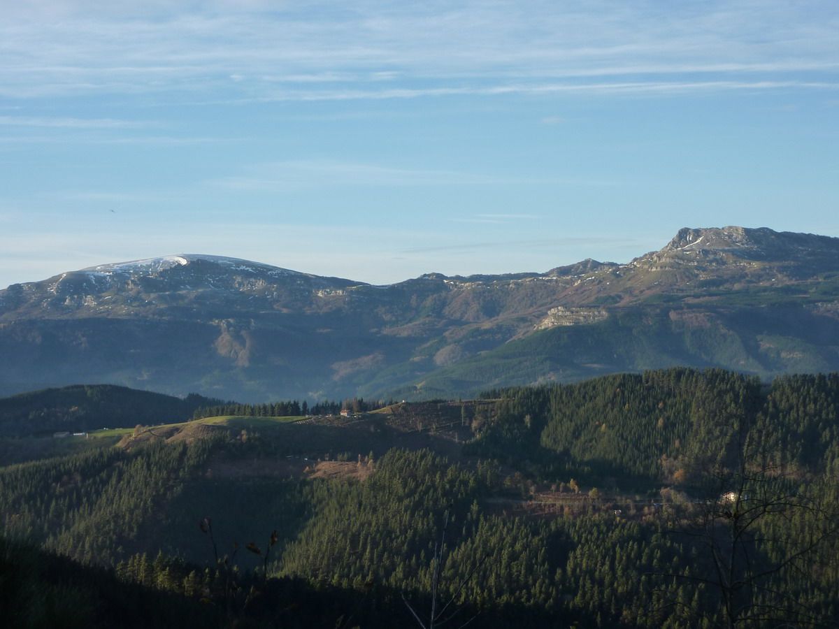
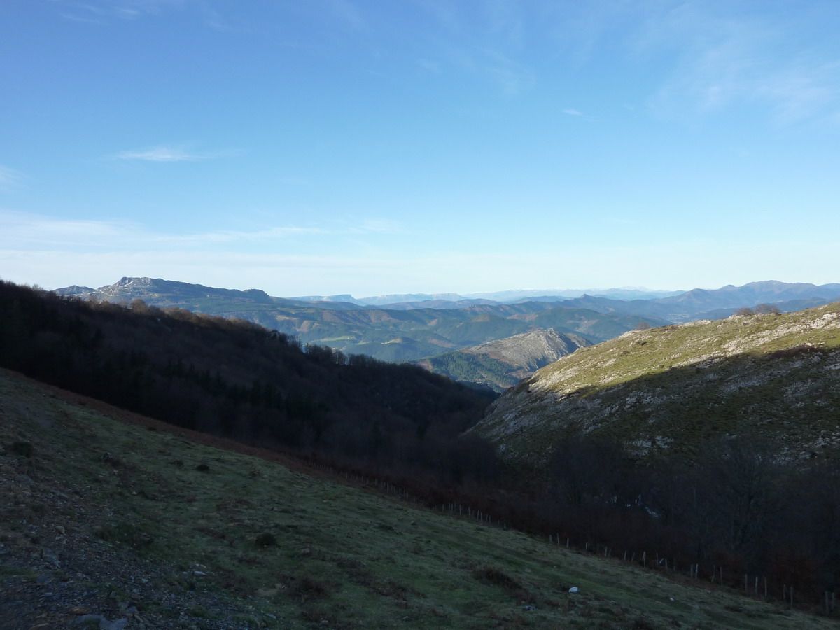
Arrian, and it is clear, right from the concrete track. Although there are clouds up hope when the sun is hot, it "dissolved" and we admire the view
is clear, no??
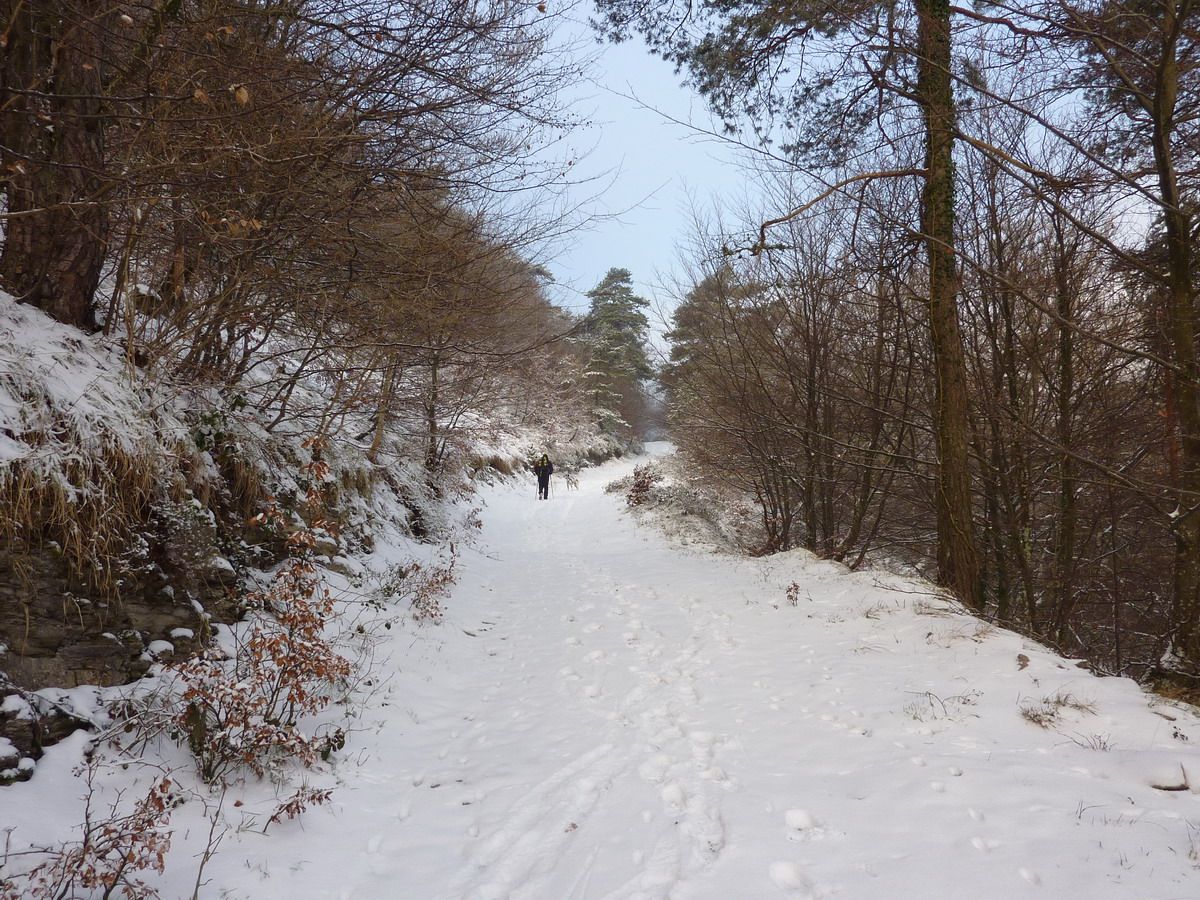
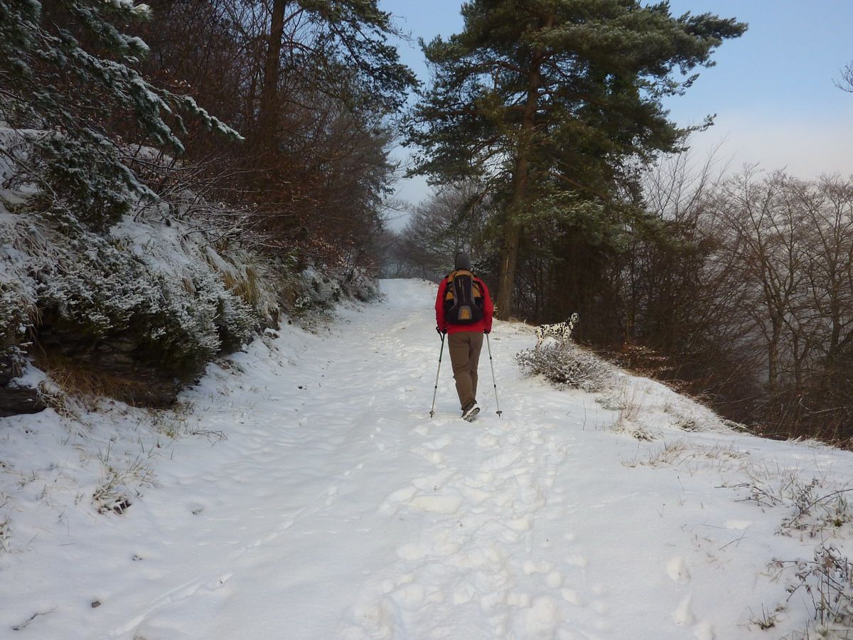
Oh! Surprise! Snow! And I just shoes ... mmmmmm ... not so good ...
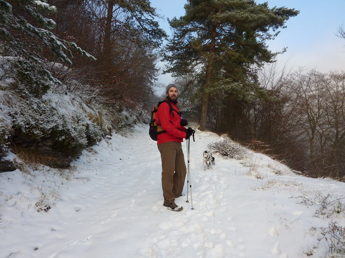
After crossing the fence, climb the path that is shown on the left
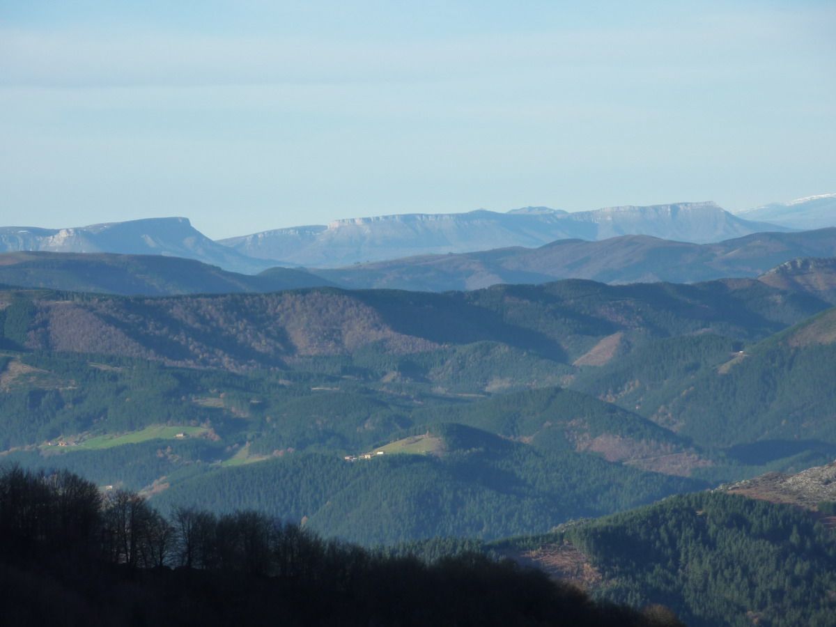
peek behind ... shyly but the sun seems to want to make an appearance.
And peek below ...
the record, I also wandered about in slippers, but walked ...;)
And nothing ... to play with the camera and snow. Some "macro"
Some photo "artistic", to use these wallpaper
And these branches if they are "glazed" ...
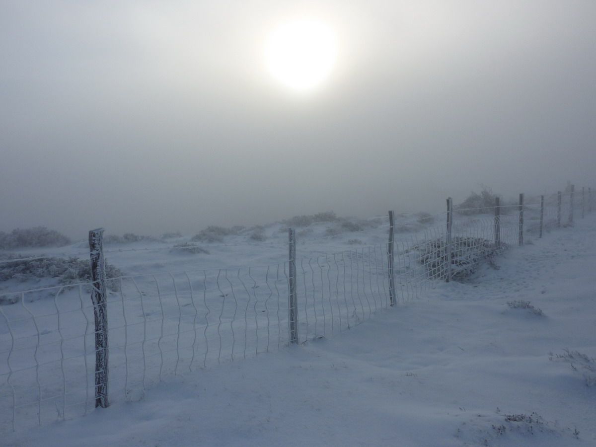
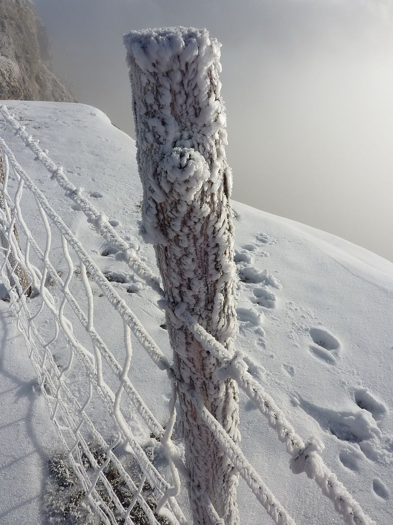
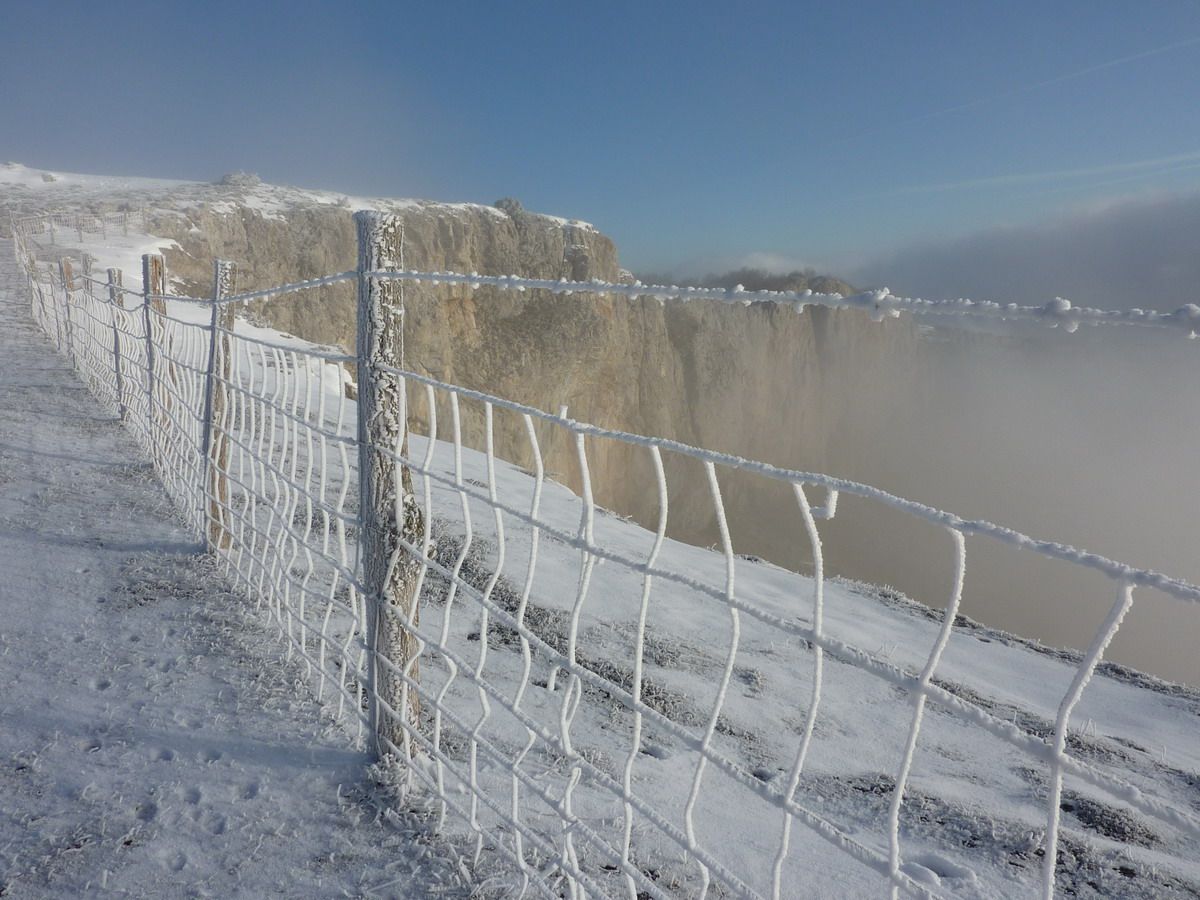
And no, we reached the gate of Melaria and the matter does not look good at all. Visibility is zero, meaning that our joy in a well and makes a chill wind. Peña Colorada climb up and see what we do then ...
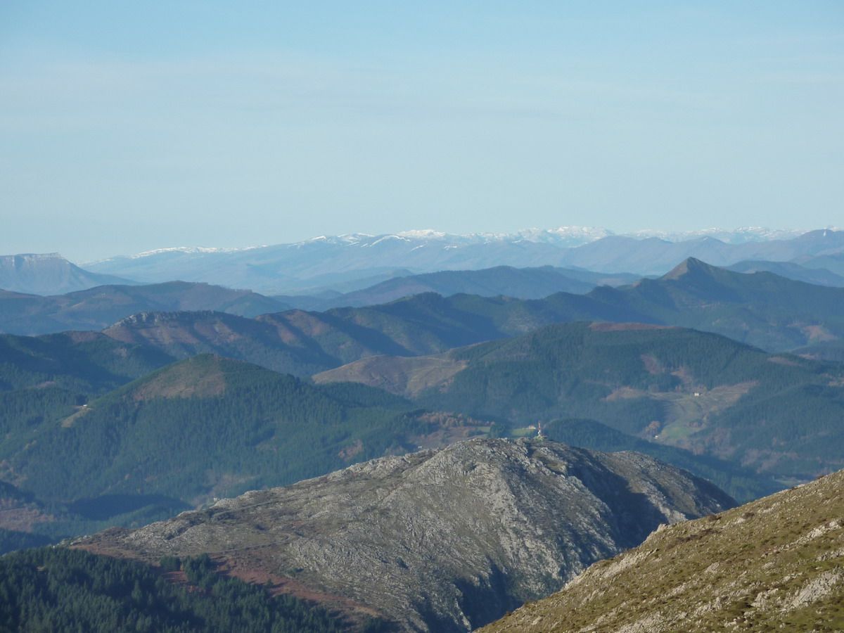
The sun tries to win the clouds but there was no way ... we are in Aruba or the pole??
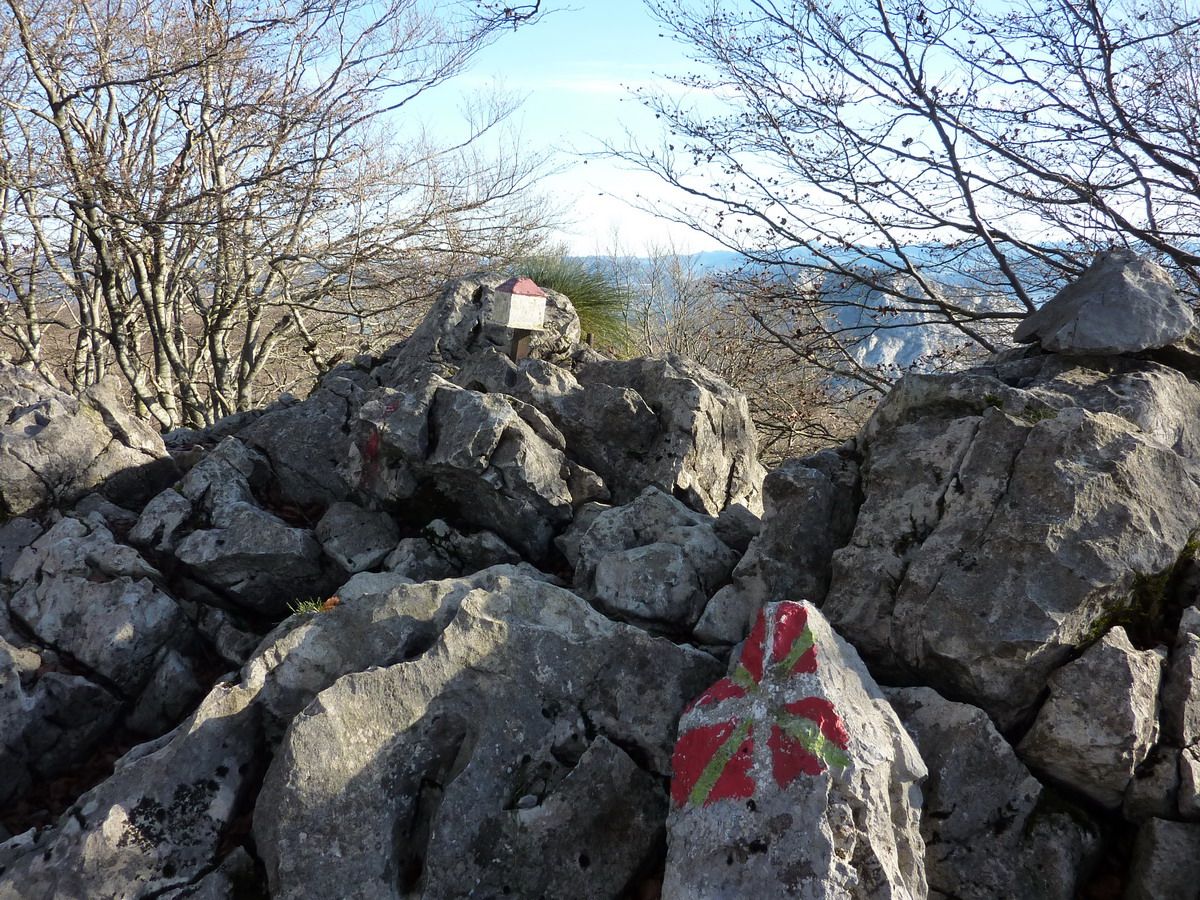
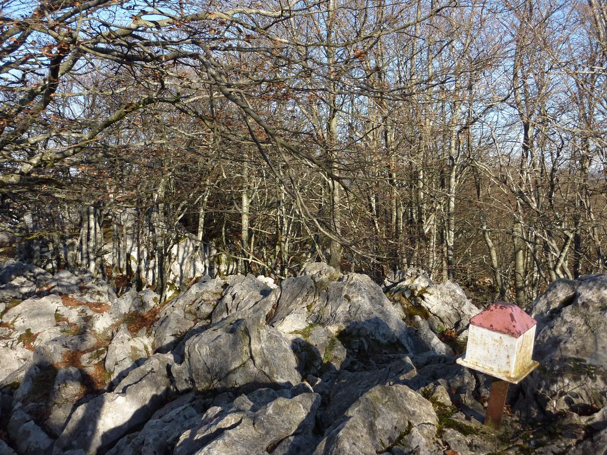
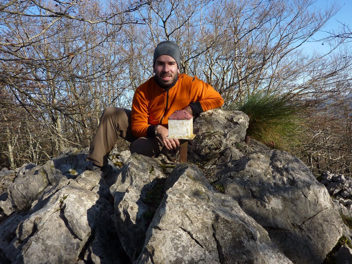
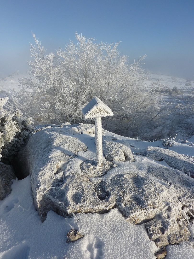
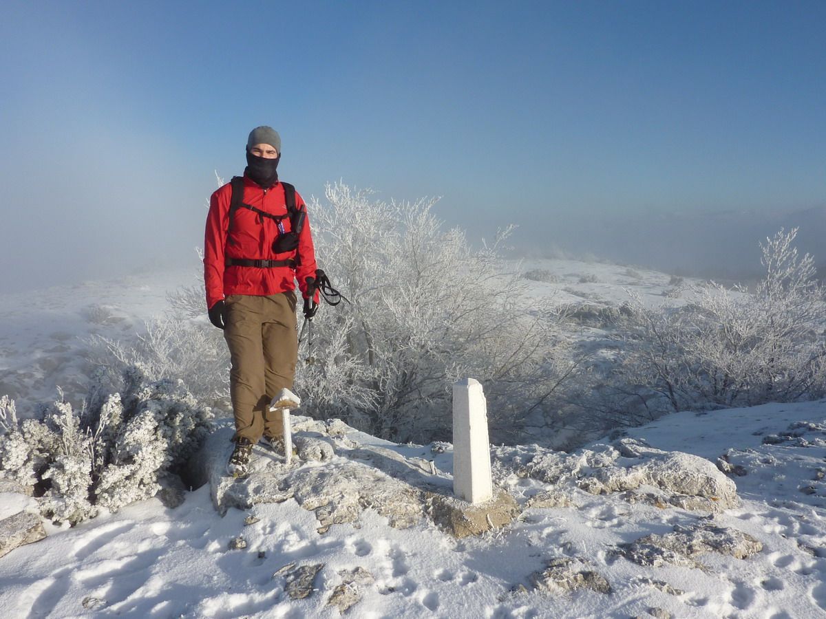
Well, at least until the Peña Colorada (1131m) where we have come.
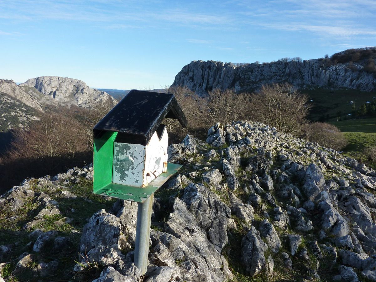
If Snapshot = If Cima.
And seeing that area and Krutzeta Repiko were completely covered, it was nonsense to walk in the fog from cold to not see anything and just get to the mailbox and say that we had arrived, which means that after 0.2 seconds of deliberation we decided to get off the fence completely frozen
With more detail
And it is, this side had no clouds, but for the other side, where we wanted to go, it looked a pepper ...
A couple of photos "artistic"
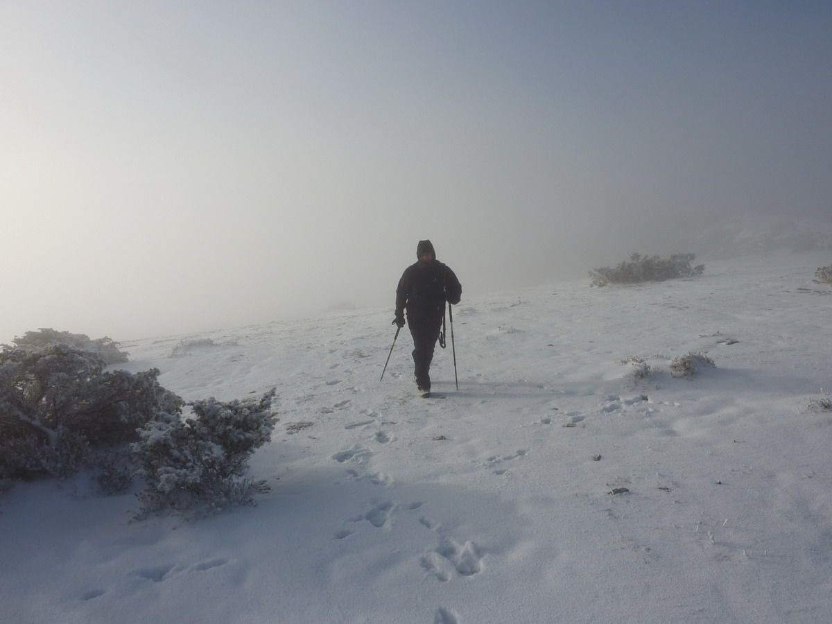
And we move along the "Antarctica"
In the fall there are no pictures, mostly because we go down kotxinero trot through the snow, but once ... Any picture below to see that the clouds did not lift more than in the area of \u200b\u200bPeña Colorada but that I kept tucked Krutzeta Repiko and the cloud. Back to the bar car and take a coffee with milk and a tortilla sandwich. Knowing Arkamu saw will have to wait for another time ... Well, it was sunny throughout Euskadi least where we were we ...;)
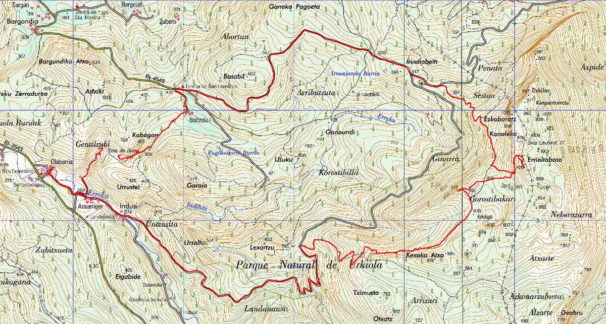
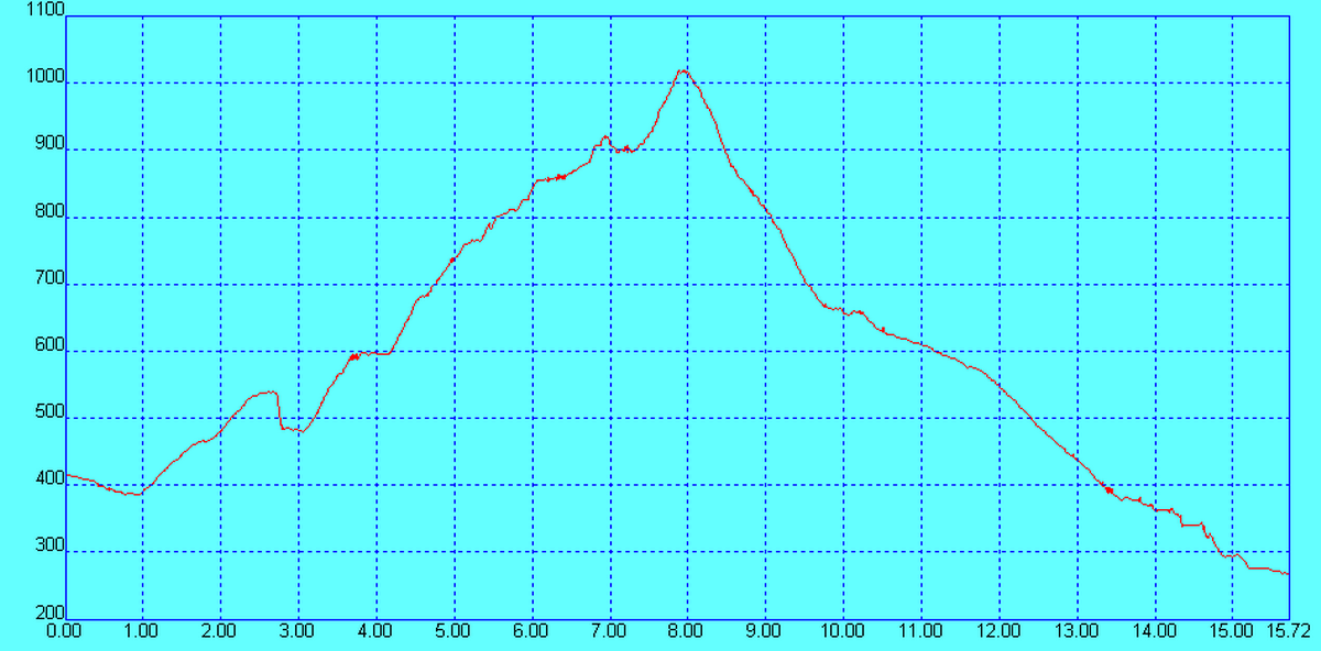
advantage that on Saturday gave good, pull a Rota track to prepare a circular Indusi leaving the neighborhood go up and spend the Errialtabaso also by the cave and tunnel Balzola Abaro. It's a simple route mostly runs along tracks, and only in the section that passes under Atxa goes Kexako forest and can be confusing. Come on, a trip perfect for a winter's morning to return home for lunch.
Tour:
On paper
More information: Area: Sierra / Massif Eskuagatx Access: Indusi Quarter (Dima) Cumbres : Errialtabaso (1018m) and Ezkumin (915mm) Length of the trail : +15.6 km ascent: +730 m
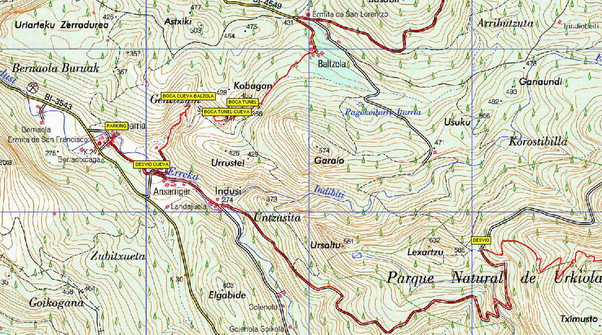
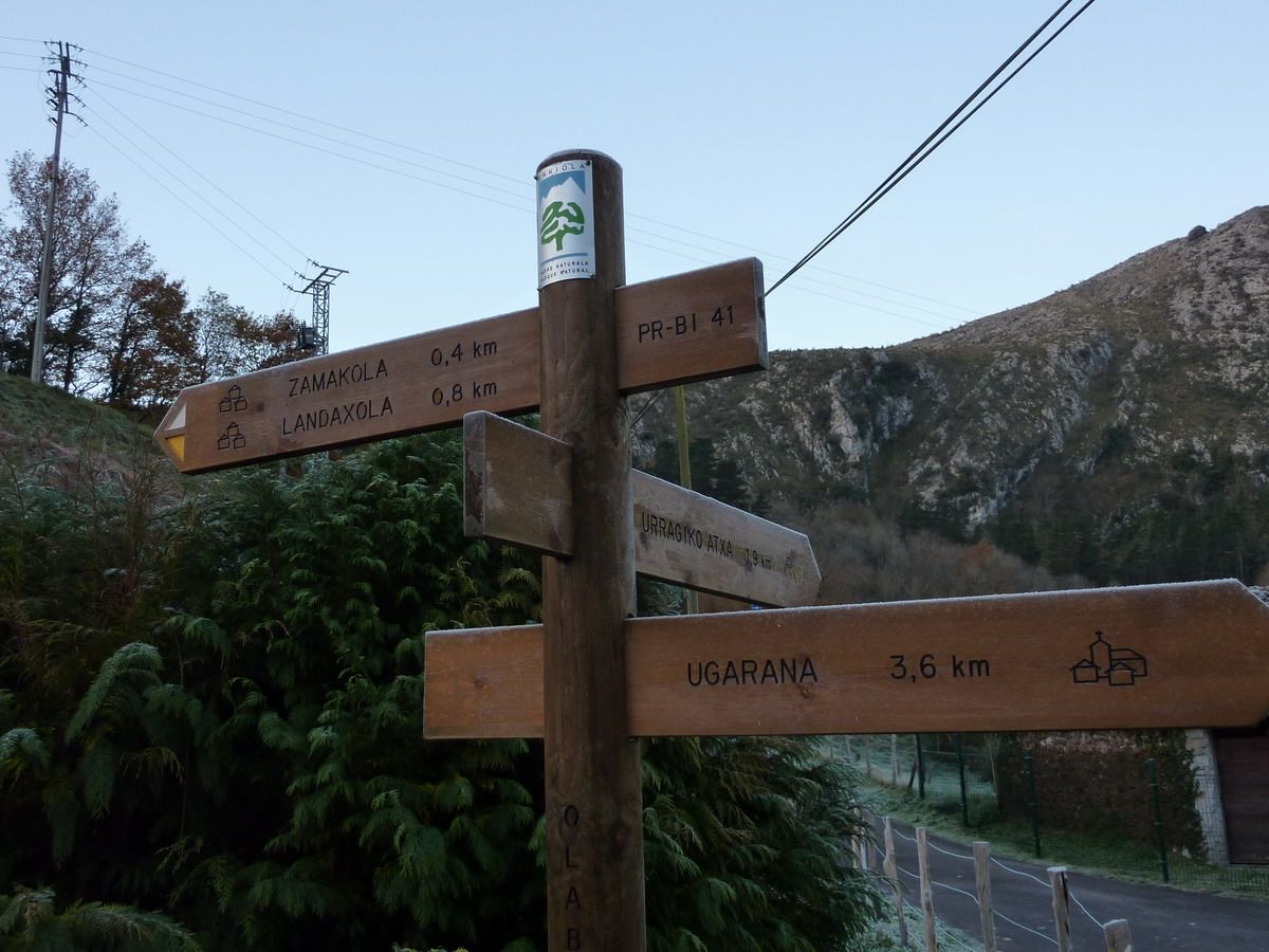
Leave your car with climbing school Indusi (then I put picture) and nothing else out there to keep moving toward Zamakola-Landaxola by PR-BI-41
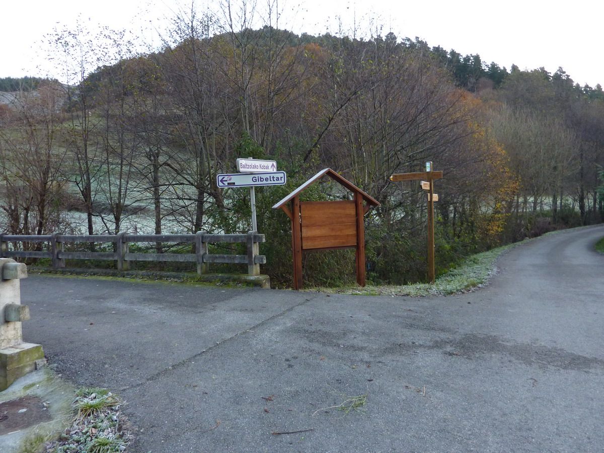
And you reach a mini-parking and detour to the hamlet Gibeltar Balzola and caves. As even the light was not very good and I wanted to take pictures, what I did was go straight
Old mill in the neighborhood of Indusi (because the car will stop in what is called Olabarria map )
As I say the road is very comfortable and runs along track (in some sections with cement). Thank goodness because if not, to see how they were going to raise the material for this reform ...
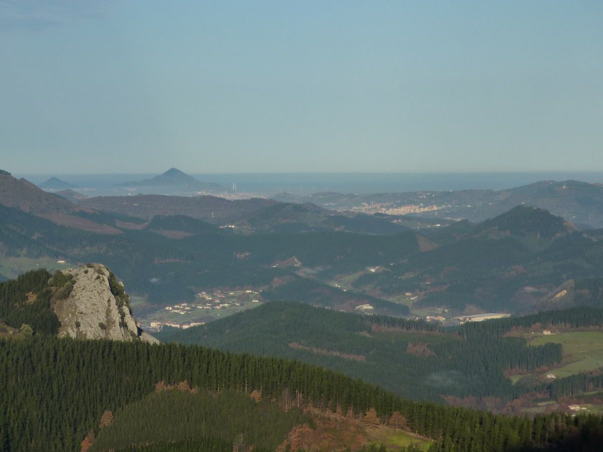
to see .. to the left, the neighborhood where I left Indusi, right, even in shadows, Balzola neighborhood. Ganeko the bottom and further back, Serafin, and through the great Bilbao ...
zoom Pulling
Leungane
Oh god! No me out with this hair ...
And this is the section that runs through Kexako Atxa, had some trees blown down and so the track looks like I drunk ...
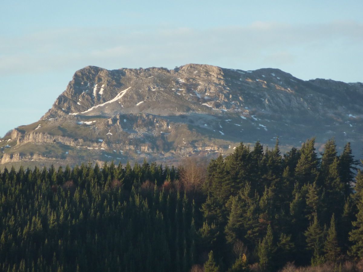
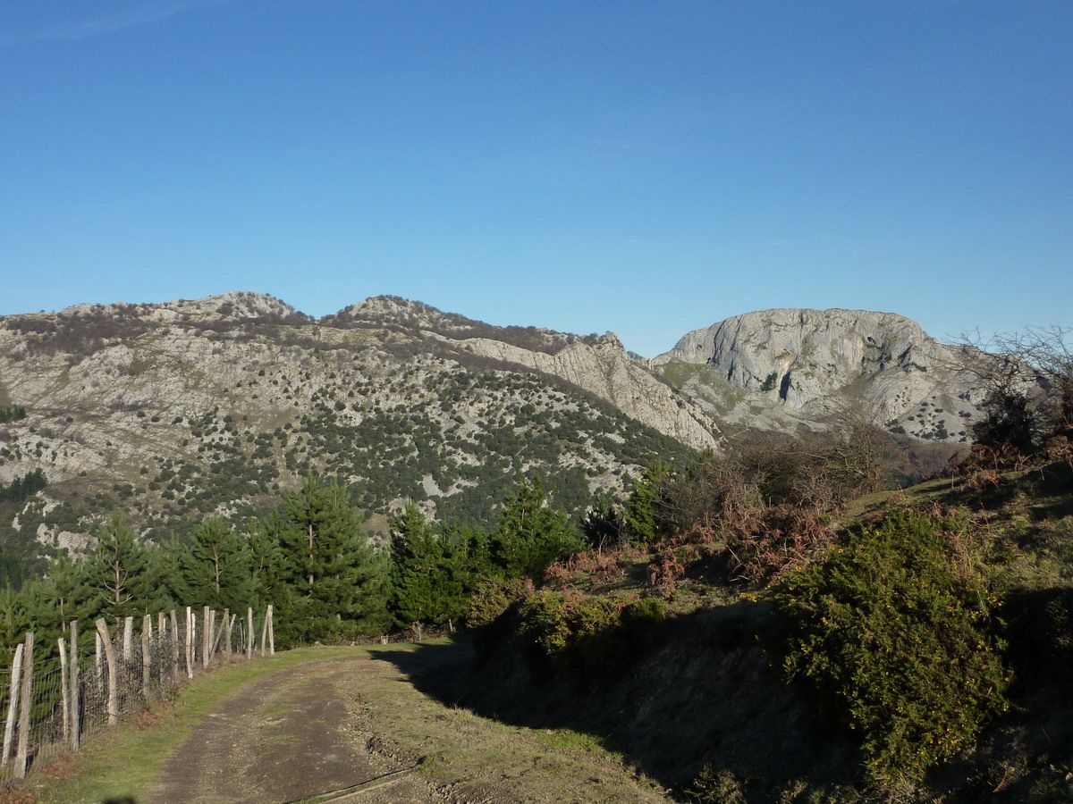
And we went to "open field". Ezkumin Left (915mm) and right the Errialtabaso (1018m).
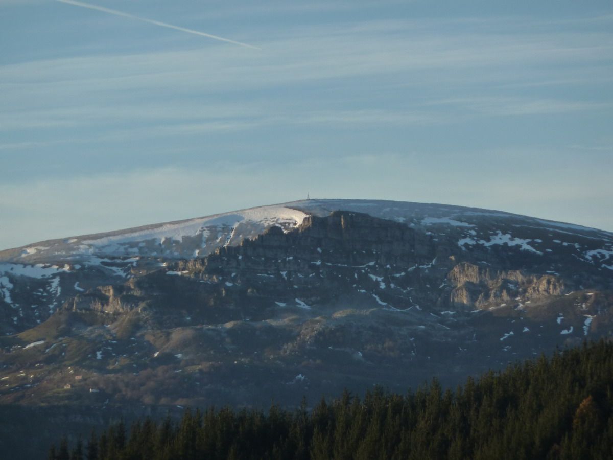
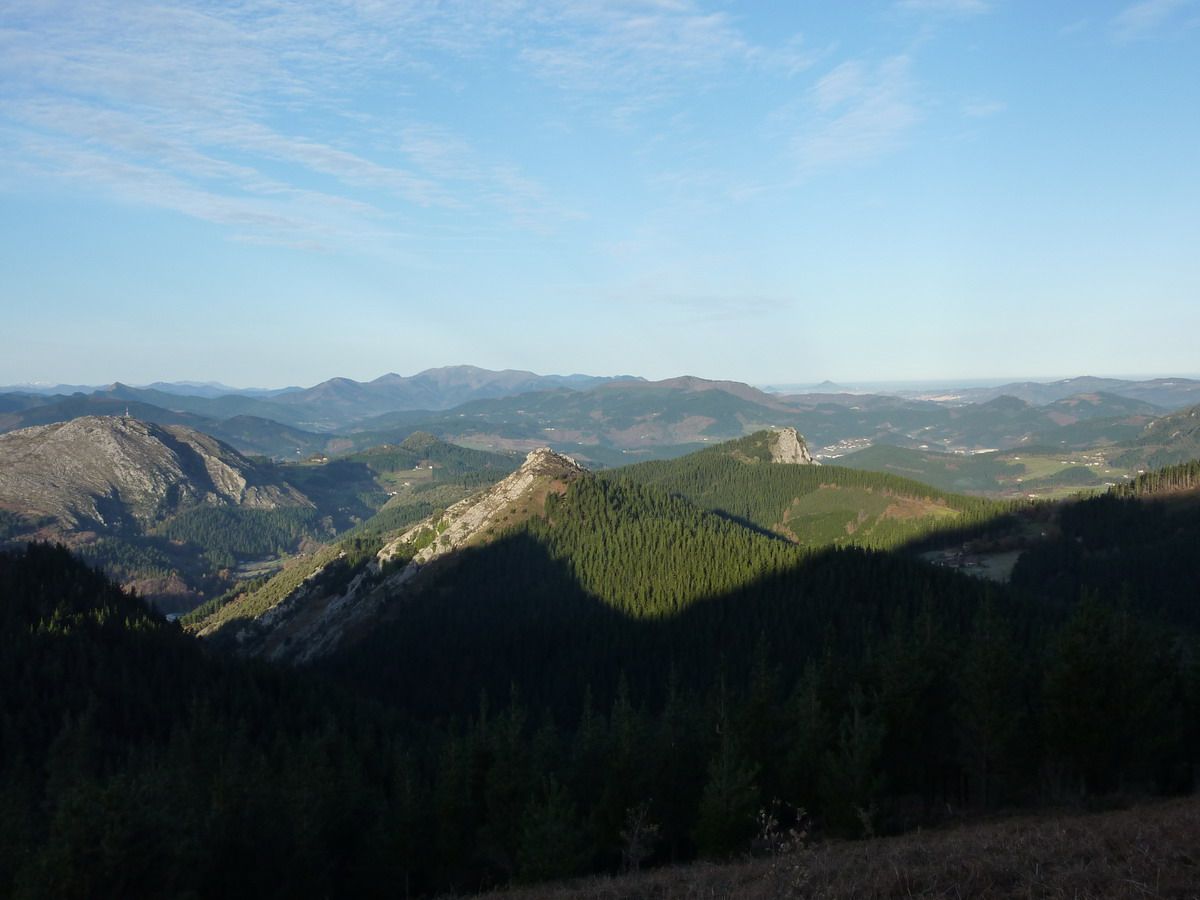
And the visibility was amazing, to the left Lekanda, then further back and right Gorobel Ganeko
Pulling zoom ... Gorobel-Sierra Salba
Mmmmm .... Lunada?? Alto Campo??
And Ganeko area
Ezkumin mailbox, with the bottom Mugarra Leungane and
Mugarra to the left and the right-hand Errialtabaso
and mailbox with Lekanda Gorbea and background ...
If Snapshot = If Cima. Ezkumin (915mm)
Neberazarra Nevero of
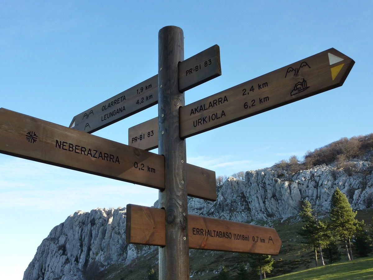
And now have to continue to Errialtabaso.Las had read reviews that talked about getting a karst area, that had to locate some kind of channel. .. At the moment this bill is clear ...
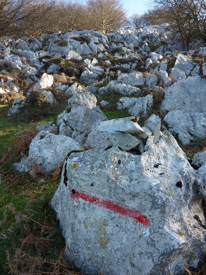
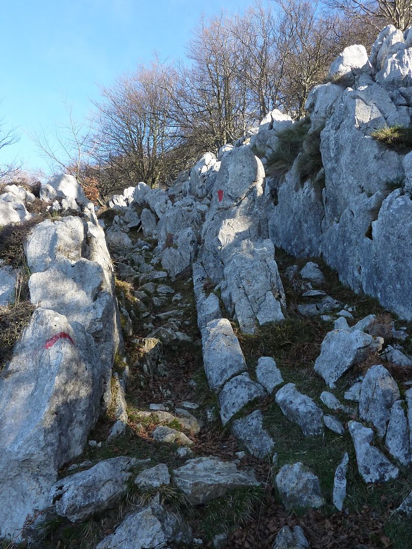
and reach the top of Errialtabaso has not lost it just follow the red marks as photo
And this is the "channel" that spoke the review.
And in a pis-pas at the top.
Pena that trees can not take best views
Searching the gap between the trees ... Untzillaitz
If Snapshot = If Cima. Errialtabaso (1018m)
And now back to the car, comfortable tracks, passing through the neighborhood and caves Balzola same Leungane nombre.Ahi front (left) and Mugarra (right) Turnout Mañaria direct lowering (another possible ascension)
Errialtabaso, for we have been there a while ago ...
Ermita de San Lorenzo in the neighborhood of Balzola
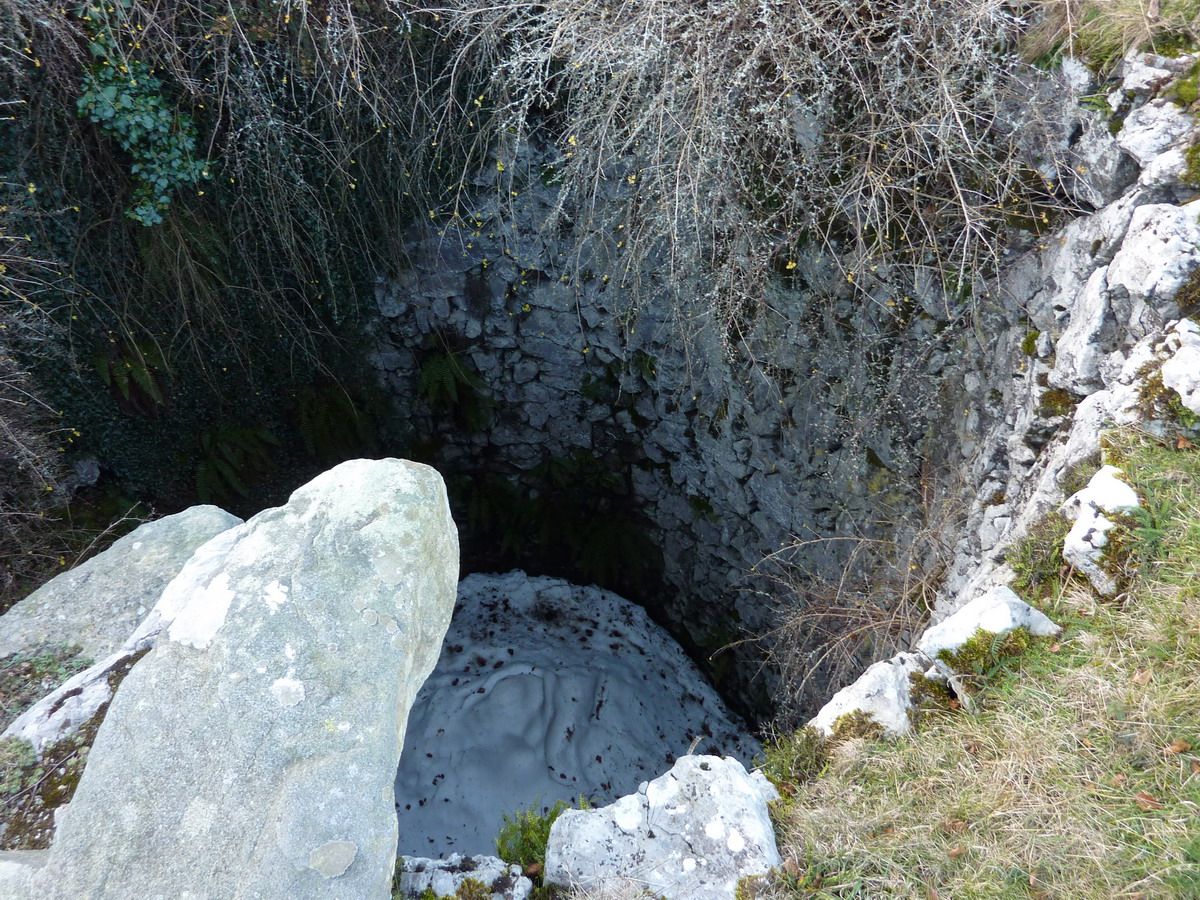
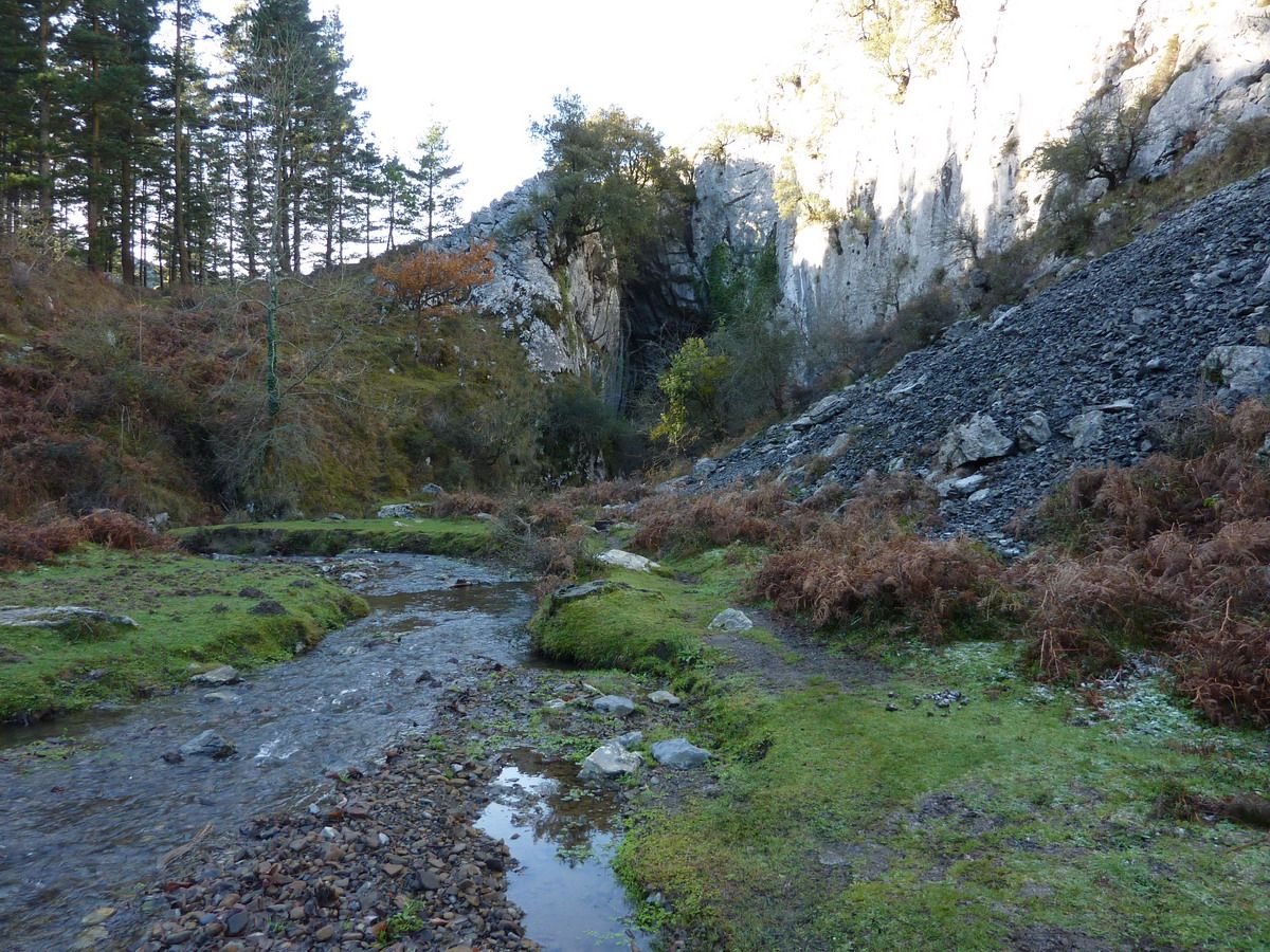
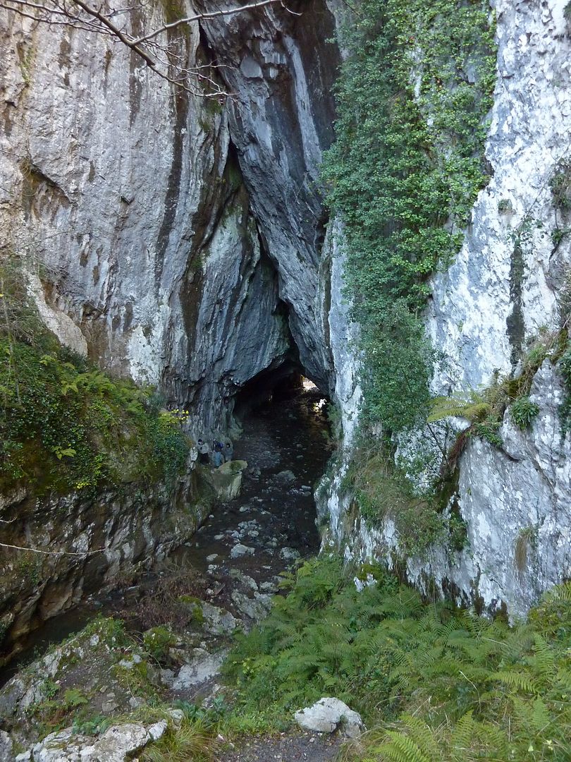
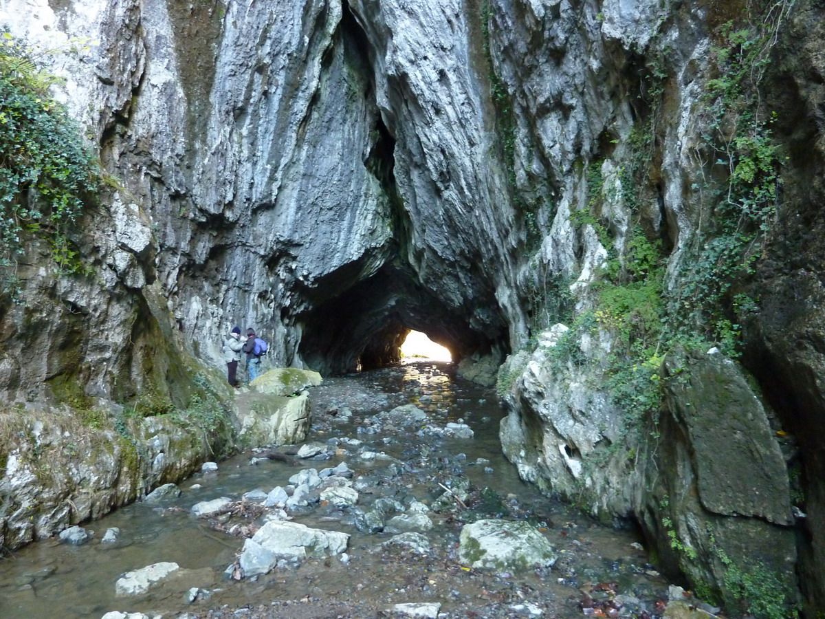
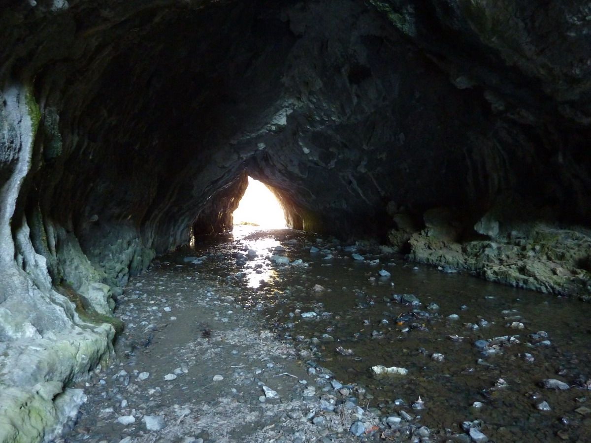
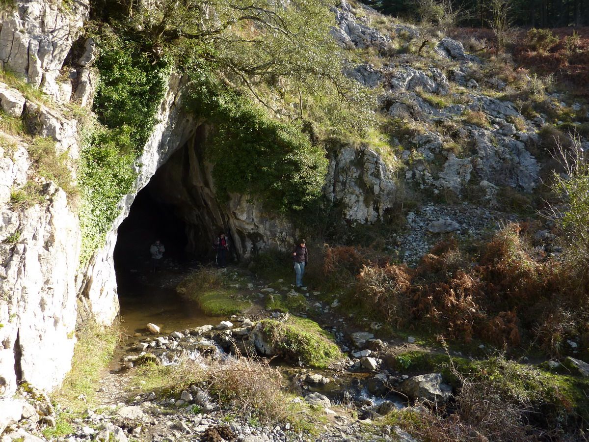
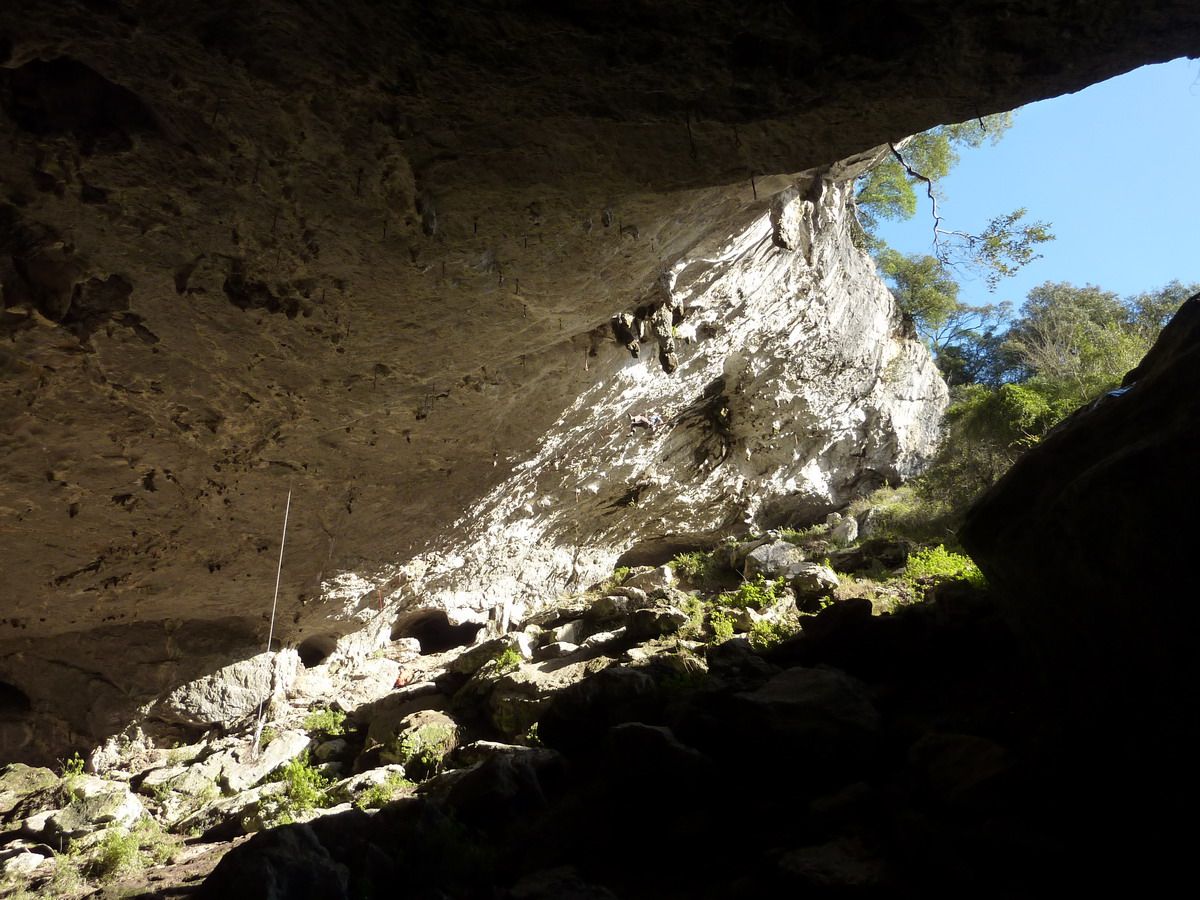
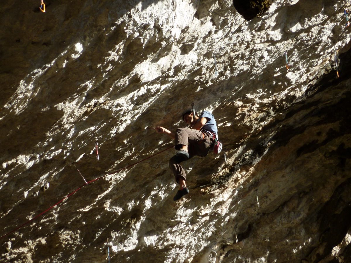
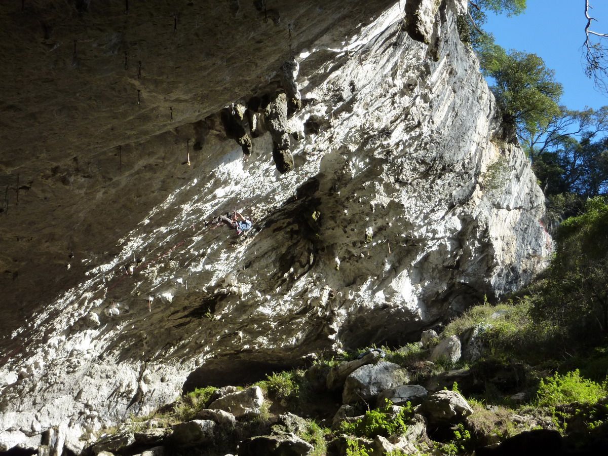
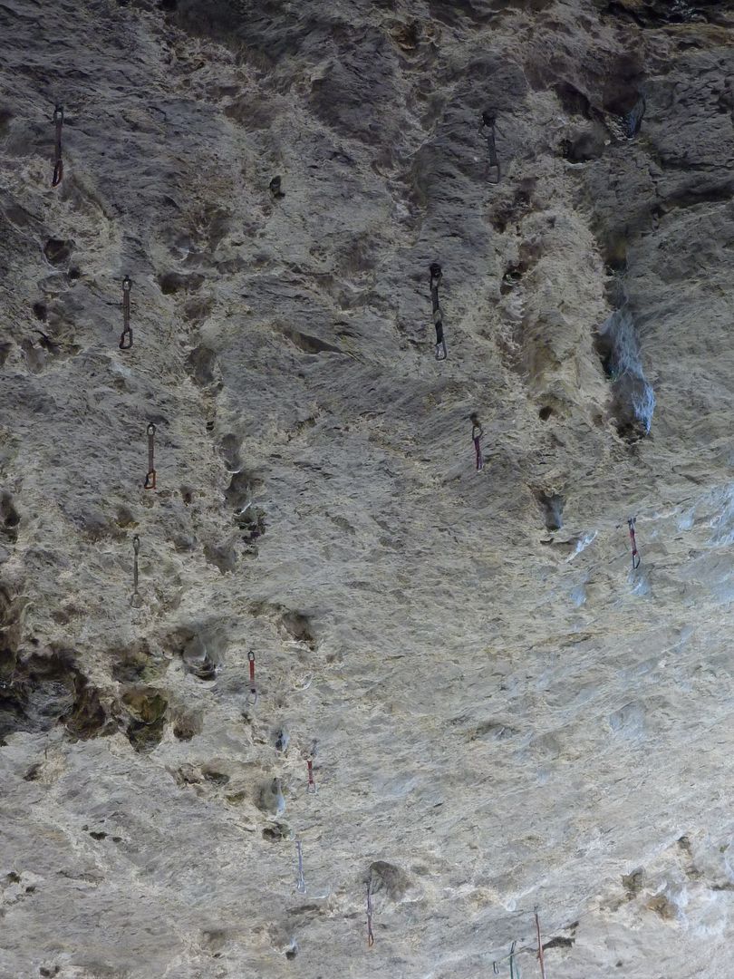
And according Balzola are going to Indusi we bump into the tunnel and caves Abaro Balzola (paradise for climbers) The tunnel entrance before there is
Abaro Tunnel. If you are going to gore-tex shoes, better to keep dry. Even if one is a bit of skill, jumping from stone to stone can evista put his foot in the water (also depends on the time of year)
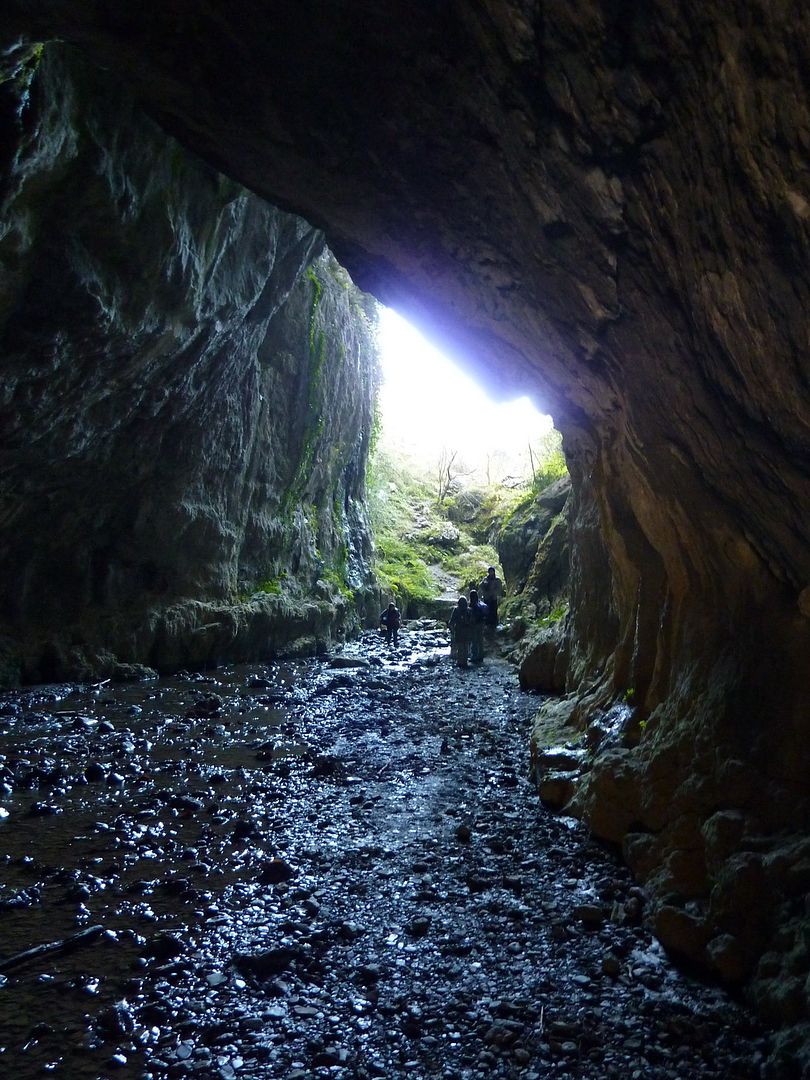
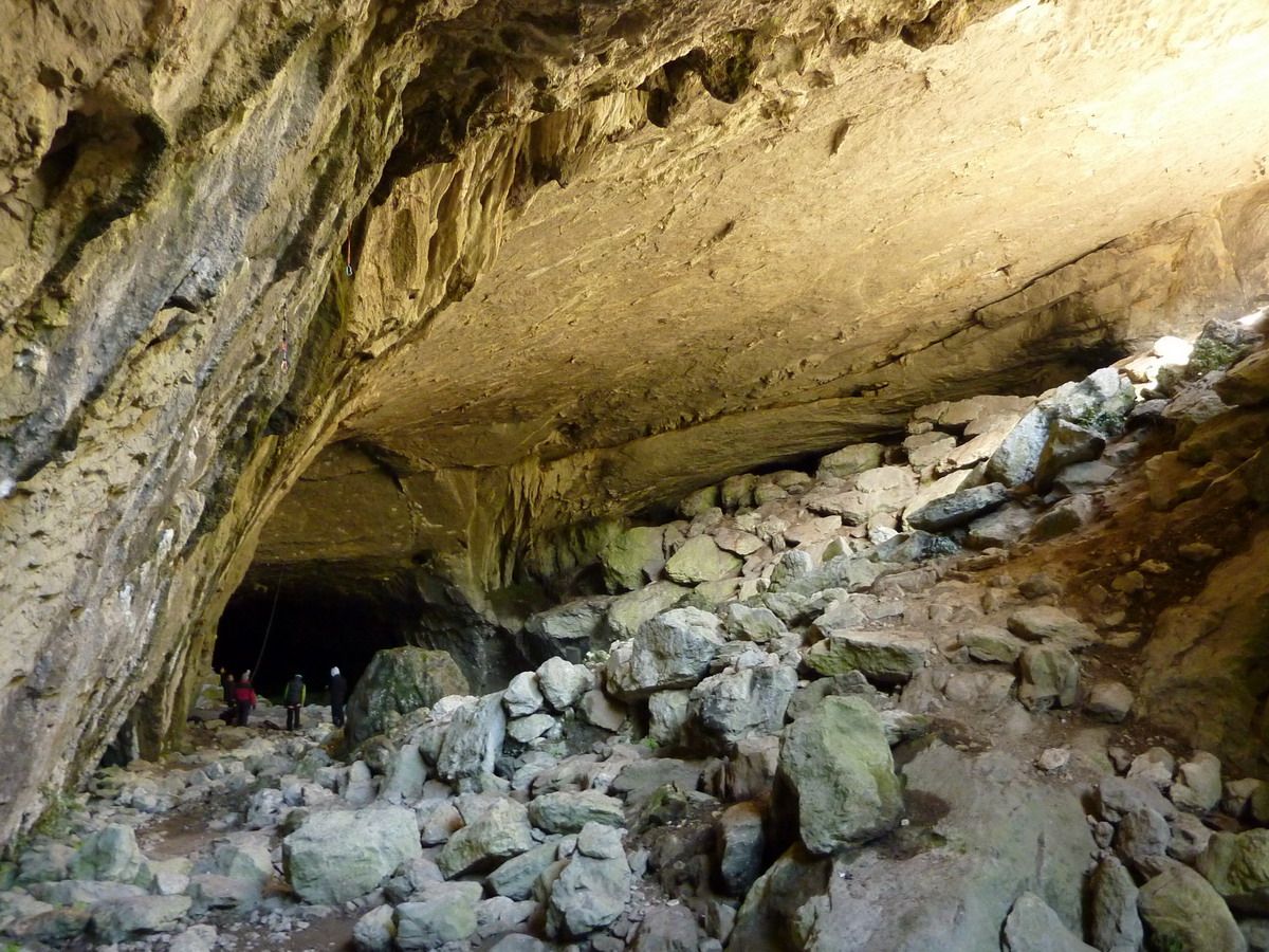
And nothing but leave the tunnel you find the cave of Balzola
No grade will be that these roads ... but I hang in there and crazy I
Go
rarest bats in this cave is
may be wrapped around and go out, but I, because I have front The walk across
The outlet (entry if you come from Indusi)
And coming to the village of Gibeltar pass under the arch of Gentilzubi, narrower than spectacular
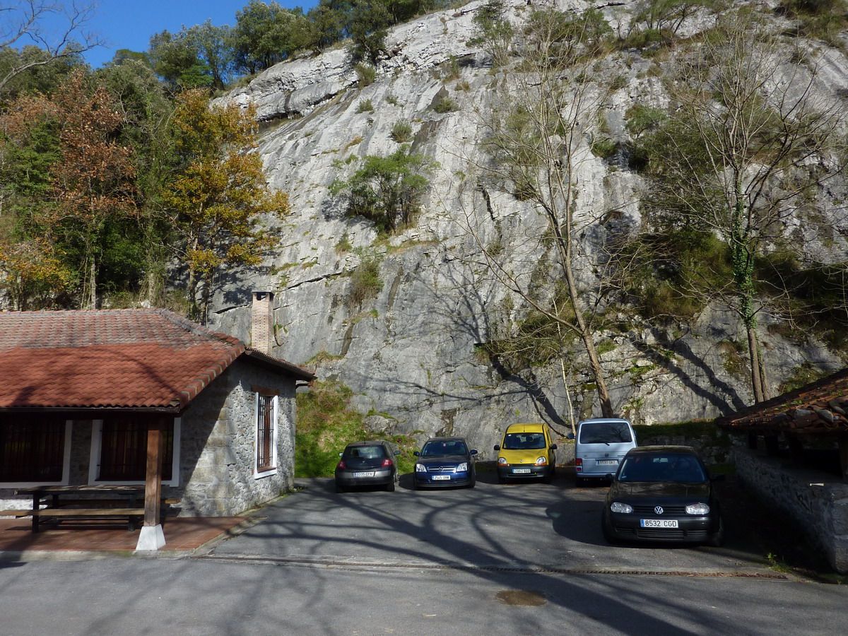
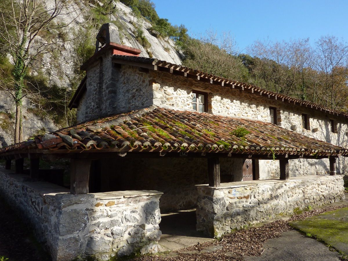
And nothing we planted at the point of origin, Indusi climbing school and chapel of San Francisco.Lo of the left is a txoko, so you have both cars ...
I said, an early-morning without major complications that also has the added bonus of going through the caves and the tunnel.


 ...;)
...;)